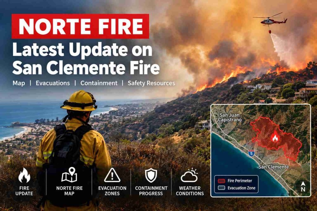
Norte Fire: Latest San Clemente Fire Update, Weather Conditions
The Norte Fire has become a major concern in Southern California after a fast-moving wildfire broke out in Orange County on October 16, 2026. Starting near San Clemente, the fire pushed toward neighboring San Juan Capistrano, threatening residential neighborhoods, damaging homes and prompting evacuation orders while firefighters fought to bring the flames under control. Strong Santa Ana winds, dry vegetation and unusually hot conditions all helped it spread quickly.
Residents, commuters and families across the region are searching for the latest Norte Fire update, the Norte Fire map, evacuation information and current containment figures. The incident has also renewed worries about California fires, especially when hot, dry winds can drive flames across hillsides and into populated communities.
This article covers the Norte Fire in San Clemente, the situation in San Juan Capistrano, reported property damage, evacuation resources, weather conditions, fire containment and reliable sources for tracking developments.
Important: Wildfire conditions and evacuation boundaries can change fast. The figures below reflect reports available from October 16, 2026, and official incident information retrieved for this article. Check the linked official sources for the latest conditions before making travel or safety decisions.
Norte Fire Update: What Is Happening in San Clemente and Orange County?
According to CAL FIRE’s incident records, the Norte Fire began shortly after 11:30 a.m. on October 16 near Portico Del Norte and Eminencia Del Norte in San Clemente. The blaze ran through dry brush and hilly terrain, and strong winds made firefighting harder.
By 9:20 p.m. on October 16, the official CAL FIRE incident update put the Norte Fire at about 570 acres with 0% containment. That means officials hadn’t yet reported any part of the fire’s perimeter as contained in that update.
The fire also affected communities near the line between San Clemente and San Juan Capistrano. News reports described homes damaged or destroyed, emergency evacuations and heavy traffic congestion in the surrounding area. The Orange County Fire Authority coordinated the firefighting effort, with state and federal support supplying extra resources.
Here are the main facts readers should know:
- Fire name: Norte Fire.
- Location: San Clemente, Orange County, California, with impacts reaching toward San Juan Capistrano.
- Reported start: October 16, 2026, shortly after 11:30 a.m.
- Latest verified acreage in the cited update: About 570 acres.
- Containment in that update: 0%.
- Cause: Under investigation.
- Primary concerns: Evacuations, threatened homes, wind-driven fire spread and hazardous travel conditions.
These figures are a snapshot of the early emergency, not a guarantee of where the fire stands today. For current acreage, containment and evacuation orders, consult the official CAL FIRE Norte Fire incident page and the Orange County Sheriff’s Department Norte Fire information page.
What Is the Norte Fire?
The Norte Fire is a wildfire in Orange County that began near San Clemente during a spell of dangerous fire weather. Unlike a small brush fire that stays out in open land, this one raised immediate alarm because the flames moved through hillside areas close to homes.
Wildfires in developed parts of Southern California make for tangled emergencies. Crews have to knock down flames, protect structures, watch shifting winds, manage road access and help residents get out. Even when a fire covers a fairly small area, its closeness to homes and travel routes can have an outsized effect.
The Norte Fire also shows why emergency officials urge residents to be ready to evacuate before a wildfire reaches their neighborhood. Wind-driven flames and airborne embers can travel well past the visible fire front, potentially threatening homes that don’t look like they’re in the fire’s path.
CAL FIRE’s incident information lists the cause of the Norte Fire as under investigation. Until authorities release verified findings, it would be wrong to blame the ignition on any particular person, electrical fault, vehicle or other source.
Norte Fire Map: Where Is the Fire Burning?
The Norte Fire map is among the most important tools for residents trying to work out whether their homes, workplaces or travel routes could be affected.
The fire started in the San Clemente area near the intersection of Portico Del Norte and Eminencia Del Norte. As it spread, emergency officials identified evacuation zones in both San Clemente and San Juan Capistrano. The exact fire perimeter and evacuation boundaries should be checked on official maps and not guessed from photos, social media posts or general location descriptions.
1. CAL FIRE incident map
Use the official incident page to review the Norte Fire’s reported acreage, containment, incident location and available updates.
2. Orange County evacuation map
Check the county’s emergency information page for current evacuation zones, orders, warnings and local assistance.
3. Additional wildfire mapping
Watch Duty offers wildfire information and map-based situational awareness. Cross-check any critical evacuation instructions with local authorities.
What should you look for on the Norte Fire map?
When you read a wildfire map, focus on these details:
- Fire perimeter: The area where the fire has been mapped. It doesn’t necessarily show every active flame or hotspot.
- Evacuation orders: Areas where residents have been told to leave immediately.
- Evacuation warnings: Areas where residents should get ready to leave and watch for official instructions.
- Road closures: Roads that emergency authorities have closed or restricted.
- Shelters: Designated places where evacuees can get help.
- Updated timestamps: The time the map or incident information was last revised.
A map can go out of date as the wind shifts or new evacuation boundaries are issued. If a street sits outside the displayed perimeter, that doesn’t automatically mean it’s safe.
San Clemente Fire: Which Areas Are Affected?
The San Clemente fire has drawn particular attention because it started near residential areas and threatened properties around the city’s inland hillsides.
San Clemente, on the Orange County coast, mixes established residential neighborhoods with open space, dry vegetation and uneven terrain. During a wildfire, those features can make access harder for fire vehicles and open up several possible paths for fire spread.
Reports on October 16 described homes burning near the boundary between San Clemente and San Juan Capistrano. Officials also issued evacuation orders covering specified zones in both communities.
Why San Clemente residents should monitor evacuation updates
A wildfire’s direction can change quickly when strong winds push flames and embers across hillsides. A neighborhood that looks far from the main fire can face new risks if the wind shifts.
Residents of San Clemente should:
- Check their official evacuation zone and not rely only on a general map of the city.
- Follow mandatory evacuation orders immediately.
- Stay out of closed roads and areas where firefighters are working.
- Watch official emergency announcements for changes to evacuation boundaries.
- Keep essential medication, ID, phones, chargers and other necessities ready in case conditions worsen.
People who have already evacuated shouldn’t go home until authorities confirm that reentry is allowed.
Is there a San Clemente fire today?
Searches for “San Clemente fire today” and “fire in San Clemente” may bring up reports about different incidents. It’s important to tell the Norte Fire apart from unrelated brush fires, structure fires and older wildfires.
The Norte Fire is the specific incident tied to the October 16, 2026, emergency near San Clemente. For a current status check on October 17, consult the official incident page and local emergency alerts instead of assuming the previous evening’s acreage or containment figure still holds.
San Juan Capistrano Fire: What Residents Need to Know
San Juan Capistrano has also been hit by the Norte Fire, especially in areas near the city’s boundary with San Clemente. The incident raised concerns about hillside properties, evacuation access and smoke in residential communities.
The Orange County Sheriff’s Department listed evacuation zones SJC04, SJC05 and SJC10 among those under evacuation orders in its October 16 incident update. San Clemente zones SCL12 and SCL13 were also listed. Because zone status can change, residents need to confirm the current designation before acting on older reports.
Via La Mirada, San Juan Capistrano
Via La Mirada became a key location in early coverage of the fire. News reports described homes in the area as damaged or destroyed, showing how quickly a wind-driven wildfire can threaten properties close to dry hillsides.
For people living near Via La Mirada, the key question isn’t just whether smoke is visible from the street. They should find out whether their address falls under an evacuation order or warning, whether access roads are restricted and whether local authorities have announced new hazards.
Don’t drive toward the affected neighborhood to photograph the fire, check on property from outside an evacuation zone or get around a road closure. Extra vehicles can block emergency access and slow down firefighting.
Is there a fire in San Juan Capistrano today?
Anyone searching “fire San Juan Capistrano,” “San Juan fire” or “fire in San Juan Capistrano” should check the Norte Fire incident information first, then see whether any other local incidents have been reported separately.
A city’s name in a headline doesn’t necessarily mean the whole community is under evacuation. Official zone maps give more precise information on which locations are under an order, a warning or no announced restriction.
Norte Fire Containment: How Much of the Fire Is Under Control?
Containment is one of the most closely watched numbers during a wildfire, but it is also often misunderstood.
In the CAL FIRE update published at 9:20 p.m. on October 16, the Norte Fire was listed at 570 acres and 0% containment. This is the latest specific containment figure cited in this article, not confirmation of the incident’s status on October 17.
What does 0% containment mean?
When a fire is reported as 0% contained, firefighters haven’t yet established a confirmed containment line around a measurable portion of the fire perimeter under the agency’s reporting standards.
It doesn’t necessarily mean firefighters are making no headway. Crews may be protecting structures, cooling hotspots, building defensive lines, clearing combustible material or running aerial operations before the official percentage changes.
Likewise, a fire at 100% containment isn’t necessarily out. Crews may still need to extinguish remaining hotspots, inspect the perimeter and head off flare-ups.
How do firefighters increase containment?
Containing a fire usually involves several coordinated activities:
- Setting up control lines where crews can safely limit further spread.
- Removing or reducing combustible vegetation where appropriate.
- Using fire engines and water supplies to protect structures.
- Deploying aircraft when weather, visibility and operations allow.
- Monitoring hotspots and fire behavior.
- Coordinating crews across different parts of the perimeter.
- Adjusting operations as wind, humidity and terrain affect the fire.
The pace of containment depends on weather, terrain, available resources, access and the fire’s intensity. Strong winds can make control lines hard to hold and can carry embers beyond established boundaries.
For that reason, anyone following the Norte Fire should watch both containment and evacuation status. A rising containment percentage doesn’t automatically cancel an evacuation order.
The Weather: Why Santa Ana Winds Made the Norte Fire Dangerous
Weather played a major part in the Norte Fire emergency. Southern California went through a stretch of strong, dry Santa Ana winds, higher temperatures and low humidity, creating conditions that let flames spread rapidly.
What are Santa Ana winds?
Santa Ana winds are typically warm, dry winds that blow from inland areas toward the Southern California coast. As air drops from higher elevations, it compresses and warms, often lowering relative humidity.
These conditions can dry out vegetation and raise the odds that a small ignition becomes a larger wildfire. Strong gusts can also push flames forward and carry burning embers into nearby vegetation or buildings.
How does weather affect fire behavior?
Several weather factors shape how a wildfire develops:
| Weather factor | Potential effect on a wildfire |
|---|---|
| Strong wind | Pushes flames forward and carries embers |
| Low humidity | Dries vegetation and other combustible material |
| High temperatures | Can increase fuel dryness and heat stress |
| Prolonged dry conditions | Leave brush and grasses more susceptible to ignition |
| Changing wind direction | Can shift the fire’s path and threaten new areas |
During the Norte Fire, wind, dry vegetation and hilly terrain together made conditions tough for firefighters. The National Weather Service warned of elevated fire danger during the regional wind event, and emergency officials urged residents to stay prepared.
Will the weather help firefighters contain the fire?
That depends on the actual conditions at the fire. Lighter winds and higher humidity can improve firefighting chances, but they don’t remove the threat from existing hotspots or burning vegetation.
On the other hand, a fresh burst of strong gusts can make a fire grow even after crews have made progress. Residents should rely on updated forecasts and official fire announcements and not assume that cooler temperatures or calmer conditions mean the danger is over.
For current forecasts, visit the National Weather Service.
How Many Homes Have Been Damaged by the Norte Fire?
Property damage has been one of the most worrying parts of the Norte Fire. Reports published on October 16 described multiple homes damaged or destroyed as flames reached residential areas near San Clemente and San Juan Capistrano.
The Associated Press reported that at least six homes had been destroyed, while other reporting described several properties affected near Via La Mirada. Early figures can differ as officials assess individual structures and separate damage from total destruction.
The final count of damaged or destroyed homes may change as inspections continue. Readers should avoid treating early estimates as a final damage assessment.
Why are homes near hillsides vulnerable to wildfires?
Hillside homes can face extra risk when dry vegetation surrounds residential properties. Wind can carry embers onto roofs, into vents and under decks, letting fires start well beyond the main flame front.
Factors that may raise the risk include:
- Dry grass, brush and shrubs near buildings.
- Leaves and other combustible debris in gutters.
- Wooden fences or decks attached to houses.
- Embers carried by strong winds.
- Limited access for fire engines on narrow or steep roads.
- Closely spaced homes that can expose neighbors to radiant heat and embers.
Homeowners can cut some of these risks by maintaining defensible space, using fire-resistant construction features and clearing combustible material close to structures. Even so, these steps can’t guarantee a property will survive a wildfire.
During an active emergency, evacuation instructions come before efforts to protect property. Residents should never delay leaving to move outdoor furniture, water plants or fetch belongings when authorities have ordered them out.
Norte Fire Evacuations: What Residents Should Do
Evacuation orders go out when authorities decide that staying in an area could expose people to unacceptable danger. In fast-moving fires, the time available to leave may be short.
The Norte Fire led to evacuation orders affecting communities in San Clemente and San Juan Capistrano. Emergency officials also named local facilities for evacuees seeking help.
How to prepare for an evacuation
If you live in an area that could be affected by the fire, take these steps:
- Check your address. Use the official Orange County evacuation information page to see whether your property is inside an evacuation zone.
- Leave immediately when ordered. Don’t wait for flames or smoke to reach your neighborhood.
- Take essential items. Bring ID, medication, phones, chargers, keys and important documents if they’re easy to grab.
- Prepare for pets. Take animals with you and follow official guidance on animal shelters and transport.
- Follow designated routes. Avoid closed roads and directions from unofficial social media posts.
- Notify family members. Tell someone where you’re going and how to reach you.
- Monitor official alerts. Evacuation orders and warnings may change as conditions develop.
If you have mobility limitations, need medical help or need assistance evacuating animals, contact the appropriate local emergency service as early as possible.
Where can evacuees find assistance?
The Orange County Sheriff’s Department’s Norte Fire information page listed the following locations in its October 16 update. Confirm availability and operating arrangements before you travel, since services may change during an emergency.
| Location | Address | Reported purpose |
|---|---|---|
| Boys & Girls Club | 1 Via Positiva, San Juan Capistrano | Overnight shelter listed in the county update |
| San Juan Capistrano Community Center | 25925 Camino del Avion, San Juan Capistrano | Evacuee assistance and reception |
| San Clemente Community Center | 100 Calle Seville, San Clemente | Evacuee assistance and reception |
The county also reported animal evacuation help through local facilities, including OC Animal Care in Tustin and the San Clemente/Dana Point Animal Shelter. Contact the county directly for current intake arrangements, opening hours and any restrictions.
Orange County California – Sheriff’s Department
For official updates, use the Orange County Sheriff’s Department emergency information page.
Are Roads Closed Near San Clemente and San Juan Capistrano?
Wildfires can affect roads through smoke, poor visibility, emergency vehicle activity, falling debris and direct exposure to flames. Evacuations can also create heavy traffic when many residents leave at once.
On October 16, reports described significant congestion on Interstate 5 near the Norte Fire. The reporting available at that time didn’t establish a Norte Fire-related Interstate 5 closure, though other fires in the region caused separate transportation disruptions.
Because highway and local road conditions can change fast, check live information before you travel.
Useful resources include:
- Caltrans QuickMap for traffic conditions, incidents and road restrictions.
- California Highway Patrol for highway safety information.
- Orange County Sheriff’s Department for local emergency announcements.
- CAL FIRE for official wildfire updates.
Don’t take a familiar route just because it’s normally quickest. A road that runs close to a fire may be limited to emergency personnel, and evacuation routes can change with little warning.
California Fires: How the Norte Fire Fits Into the Southern California Wildfire Situation
The Norte Fire developed during a wider period of elevated wildfire danger across Southern California. Other fires reported during the same weather event included the Henderson Fire near Camp Pendleton and the Bryson Fire in Malibu. These were separate incidents, each with its own location, perimeter, containment figures and emergency instructions.
That distinction matters, because searches for “fires in Southern California,” “California fires” and “Orange County fires” can pull together reports about several incidents. A closure or evacuation linked to one fire doesn’t automatically apply to another.
Why does Southern California experience dangerous wildfire conditions?
Southern California has a mix of climate and geography that can fuel fast-moving wildfires.
- Seasonal dry vegetation: Grass, brush and other plants can become highly combustible after long stretches without significant rain.
- Strong offshore winds: Santa Ana wind events can carry flames and embers toward coastal communities.
- Hilly terrain: Slopes and narrow access roads can complicate firefighting and evacuation.
- Urban-wildland interfaces: Many neighborhoods sit next to open land, where vegetation and homes meet.
- Long periods of warm weather: Dry conditions can last into autumn and sometimes beyond, extending the period of heightened fire risk.
None of this means every windy day will spark a wildfire. It does explain why fire agencies step up preparedness when forecasts call for low humidity, dry fuels and strong winds together.
How can residents prepare for future California fires?
Preparation is worthwhile even when no evacuation order is in effect. Residents can make a family communication plan, identify several routes away from home, put together emergency supplies and sign up for local alerts.
Homeowners should also keep up defensible space where required, clear combustible debris around structures and think through how household members and pets would get out under time pressure.
People who live outside the Norte Fire area should keep watching their own local authorities. Fire risk is regional, but evacuation instructions are specific to each incident and community.
How to Follow the Norte Fire Update in Real Time
Finding reliable information during a wildfire can be hard, since online posts, television reports and unofficial maps may reflect different moments in time.
The best approach is to put official incident records first for acreage and containment, local emergency agencies for evacuation instructions and transportation authorities for road conditions.
Official Norte Fire resources
CAL FIRE
Incident status, reported acreage, containment and updates.
Check the Norte Fire incident page
Orange County Sheriff’s Department
Evacuation zones, local assistance, shelters and emergency information.
Check county emergency updates
CAL FIRE statewide incident information
Review other California fires and compare incident reports.
Browse active wildfire incidents
National Weather Service
Forecasts, wind information, heat advisories and fire-weather warnings.
Check official weather forecasts
What should you check in each Norte Fire update?
When a new report appears, look for five key pieces of information.
- Timestamp: When was the information published?
- Acreage: How much land has burned according to the latest assessment?
- Containment: Has the reported containment percentage changed?
- Evacuations: Have orders been added, expanded, downgraded or lifted?
- Structures and injuries: Have officials released verified damage or injury figures?
A newer update may revise an earlier estimate and doesn’t necessarily mean things have suddenly gotten worse. Different agencies may also publish at different times. For safety decisions, follow the latest instructions from the authorities responsible for your location.
Frequently Asked Questions About the Norte Fire
1. Where is the Norte Fire located?
The Norte Fire started near Portico Del Norte and Eminencia Del Norte in San Clemente, Orange County, California, on October 16, 2026. It spread toward neighboring San Juan Capistrano.
2. How large is the Norte Fire?
The latest specific incident update cited here, published by CAL FIRE at 9:20 p.m. on October 16, reported about 570 acres burned. Check the official incident page for any later acreage changes.
3. What is the Norte Fire containment percentage?
CAL FIRE reported 0% containment in its October 16, 9:20 p.m. update. That historical figure shouldn’t be read as the current containment percentage without checking a newer report.
4. What caused the Norte Fire?
The official incident records list the cause as under investigation. No specific ignition source should be treated as confirmed until authorities release verified findings.
5. Are San Clemente and San Juan Capistrano under evacuation orders?
Evacuation orders were reported for designated zones in both cities on October 16. Whether a particular address is still under an order depends on the latest official instructions. Check the Orange County Sheriff’s Department’s Norte Fire page before traveling or returning home.
6. Where can I find the Norte Fire map?
Use the official CAL FIRE incident page and the Orange County emergency information page. The county page gives access to public information about evacuation areas.
7. Is Via La Mirada affected by the fire?
October 16 news reports named properties near Via La Mirada in San Juan Capistrano among those affected by the Norte Fire. Residents should check their specific addresses and current evacuation status and not rely on the street name alone.
8. Why is the weather important during the Norte Fire?
Strong Santa Ana winds, low humidity, dry vegetation and high temperatures can raise the speed and intensity of wildfire spread. Changing conditions may also create new hazards even after firefighters have made progress.
9. Where can people affected by the Norte Fire find shelter?
The county’s October 16 update listed the Boys & Girls Club in San Juan Capistrano as an overnight shelter and named community centers in San Juan Capistrano and San Clemente for evacuee assistance. Check the county’s latest announcements for current availability and instructions.
10. Where can I check other fires in California?
The CAL FIRE incidents page offers statewide wildfire information, including incident locations, acreage and containment where available. For evacuation orders, always consult the local agency responsible for the affected area.
Final Thoughts on the Norte Fire
The Norte Fire underlines the serious risks California communities can face when strong Santa Ana winds meet dry vegetation and homes built near open hillsides. The wildfire began in San Clemente on October 16, 2026, spread toward San Juan Capistrano and forced evacuations while firefighters worked to protect homes and limit further spread. Early reports also documented property damage and difficult conditions for emergency crews.
For anyone following the Norte Fire, the top priorities are accurate information and personal safety. Watch official updates on containment, acreage, evacuation zones and weather; stay away from closed roads and active firefighting areas; and follow evacuation instructions right away. Conditions can change quickly, so the most recent official information should always override older news reports, maps and social media posts.